


PHOTOGRAMMETRY MODULE
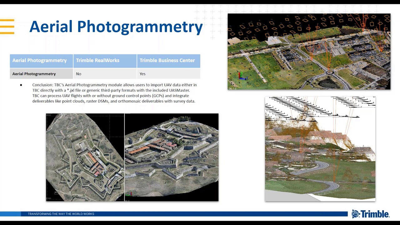
TBC's optional Aerial Photogrammetry module provides additional functionality to Trimble Business Center. Based on state-of-the-art technology from Inpho, the photogrammetry module allows users to import ground control points (GCP) names and coordinates and aerial survey data and images collected from industry-leading unmanned aerial vehicles (UAVs) with streamlined workflows in TBC or customize the setup with the included Inpho UASMaster software. Geospatial professionals can produce deliverables, including orthophotos, 3D point clouds and digital surface models directly from Trimble Business Center.
Measure and model from Trimble VISION and UAS data with highly automated workflows images in the comfort of your office
-
Accurately extract 3D geometry and features from images to create rich CAD and GIS deliverables
-
Create high resolution point clouds, orthomosaics and elevation raster DSM/ DTMs
-
Create accurate 3D terrain models for volumetric computations and design
-
Seamlessly integrate UAS deliverables with other surveyed data types
The TBC Aerial Photogrammetry module facilitates comprehensive workflows for Survey, GIS, and specialist service providers wanting to create deliverables from traditional data types or expanding to the latest point cloud and imagery data from terrestrial, mobile and aerial sensors.

TBC Aerial
Click on the video menu above to access the informative videos we’ve prepared to introduce you to the Trimble Business Center Aerial Photogrammetry module. In this series of brief videos, you can gain more insight and information about the value of TBC Aerial, including:
-
Overview and purpose of the software;
-
Core features and benefits provided;
-
Key applications and uses; and
-
Demonstration of its operation and functionality.
We invite you to view these videos and begin to experience the professional power, reliability and productivity of the TBC Aerial Photogrammetry module.

